Mapping Prehistoric Crop Marks
There is an abundance of prehistoric crop marks visible (from time to time) on satellite and aerial images of the Welland valley. Some have been explored in the course of archaeological excavation, as at Etton, Lolham and Tallington.
There is the tantalising possibility that with modern mapping tools we can start to draw together a more integrated and revealing map of these features and boundaries. It is believed that these marks predominantly date to the late Neolithic, Bronze Age and Iron Age (3000BC to AD50), and reflect a busy agricultural landscape. They define settlements, field boundaries and ceremonial features.
Local resident, Ian Abbott-Donnelly, has started to compile these marks and has kindly agreed to share these via the Peterborough Archaeology website. Please zoom in on the interactive map above to explore the detail.
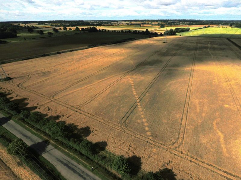
So what are these prehistoric crop marks? They are typically the result of ditches created by early farmers, cut into the underlying gravel. They were long ago filled by silts and soil which enable them to hold water for better development of growing plants. The images are often complex and confusing – showing field patterns, settlements and monuments that have existed over thousands of years.
This area is popular for gravel quarrying and over the recent years there has been a series of archaeological surveys prior to extraction. The archaeology may be destroyed but recent studies are in fact adding to our knowledge of prehistoric land-use, settlement and lifestyles.
Examples of Prehistoric Crop Marks


Prehistoric Crop Marks – More Information
Stowe Farm, Lincolnshire: A Multi-Period Archaeological Site in its Landscape, Andrew Hatton
Historic England Virtual Aerial Map – Includes detail between Stamford and Bainton
Historic England – Aerial Investigation and Mapping Methodology
Mapping Ancient Landscapes in Northamptonshire, Alison Deegan, Glenn Foard (link to chap 6)

