Condensing more than 10,000 years of Peterborough history into a simple timeline begs more questions than it answers – but hopefully provides an historical framework for the various topics mentioned on the Peterborough Archaeology website.
There were thriving communities living in this area long before the name “Peterborough” was introduced in Medieval times.
The area was attractive to early settlers with close proximity of woodland, fertile farmland and wetlands.
Underlying clay,gravel and limestone have long provided important materials for industry and construction.
The location at the intersection of major north-south arteries of Britain with the River Nene ensured strategic importance in terms of communications.
Peterborough History – Timeline
Select a period below to find out more about what was going on in and around Peterborough.
Stone Age people initially led “hunter-gatherer” lives.

Mesolithic flint tools from Kelling Heath
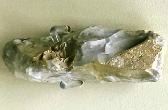
Mesolithic Flint Chisel, Woodwalton Fen (Peterborough Museum)
During this period major climatic changes occurred and most dramatically the rising level of the North Sea and the demise of the land bridge to Europe by about 6,500BC forced a retreat of some to higher ground to the west.
Towards the end of this period we see first signs of settlement and farming in the area.
Well organised communities developed with the skills and resources to undertake sizeable projects. The cursus near Maxey was probably constructed about 6,000 years ago and comprised a monumental enclosure bounded by ditches.
Between 1350BC and 1000BC a wooden causeway was built across the marshes from the mainland at Flag Fen to a settlement on slightly elevated ground at Whittlesey. The 1km long structure comprised 60,000 upright timbers and 250,000 horizontal planks.
Some of these Bronze Age people lived in round houses raised on stilts above the water. One group of nearly new houses near Whittlesey (Must Farm) caught fire; the buildings and all their domestic contents fell into the mud below to be preserved for 3,500 years.
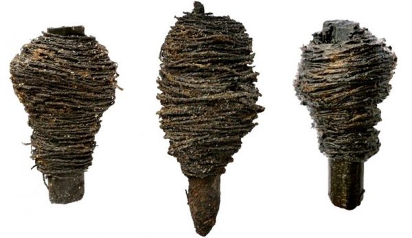
Bobbins with thread from Must Farm
Wild fowl and fishing were important for our ancestors living along the meandering waterways of the Fen edge; they navigated these waters with log boats formed from a single tree.
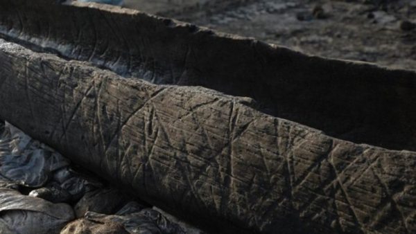
Must Farm log boat at Flag Fen
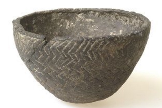
Distinctive pottery dating from this era has become known as Peterborough ware. It is decorated with pitted designs made with cord, bones, sticks and fingernails.
Roundhouses were the dominant form of building in the later Bronze and Iron Ages. Earlier houses often had internal roof-support posts suggesting use of turf for roofing; Iron Age houses tend not to have this feature suggesting use of thatch.
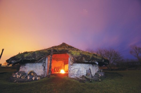
Reconstructed Round House at Flag Fen
Technology was advancing much more quickly with increasingly sophisticated bronze tools and weapons, then from about 700BC iron started to be used.
Coins appear at the end of the second century BC reflecting and enabling more trading and specialisation of activity.
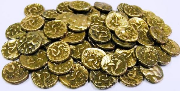
Gold coins from Kimbolton
Even before the Romans invaded their influence started to be felt in terms of technology and lifestyles. Many of the sites excavated from this time, including Fane Road in Peterborough and Wilmington Road in March, show significant continuity through Iron Age and Roman times.
Whilst there is no hard evidence for an Iron Age settlement or fort in current day Peterborough there is speculation that a kink in the ancient Fen Causeway (a road running west from Norfolk via Flag Fen) indicates such a site between Spital Bridge and Westwood Bridge.
And there was an Iron Age fort (with possible Bronze Age origins) at Borough Fen, just a few miles to the north west between current day Peakirk and Newborough.
The Romans invaded Britain in 43AD. Within 4 years they were building a large fort at what is now Thorpe Wood Golf Course.
It was from the fortress at Longthorpe that the Ninth Legion set out to battle Queen Boudica when her Iceni tribe rose in revolt against the Romans in 61; and it was back to Longthorpe that the legion fled after being ambushed by Boudica, with 80 per cent of its soldiers dead.
With the building of a more substantial bridge near current day Water Newton, first a fort and then a fully fledged Roman town was established – Durobrivae. Ermine Street, the main route north from London, ran right through the middle of the town.
Nearby, where Castor parish church is located, was one of the largest and most elaborate Roman buildings in the country. It is thought the “Praetorium” was involved in regional administration and tax collection.
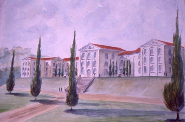
Artist’s Impression of the Praetorium
Between Durobrivae and the Praetorium was an extensive industrial area with emphasis on pot and iron production.
The Romans also constructed a 122 kilometre canal along the fen-edge from Waterbeach in Cambridgeshire, skirting Eye, Dogsthorpe and Werrington and northwards to join the River Witham south of Lincoln. Whether for transport or drainage we cannot be sure but we now call this waterway Car Dyke.
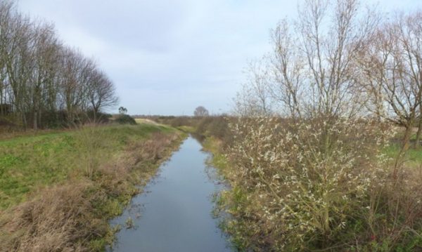
Car Dyke, Werrington (Richard Humphrey)
Durobrivae is classed as a “Roman small town” but this belies its size, the presence of public buildings and its extensive industrial suburbs.
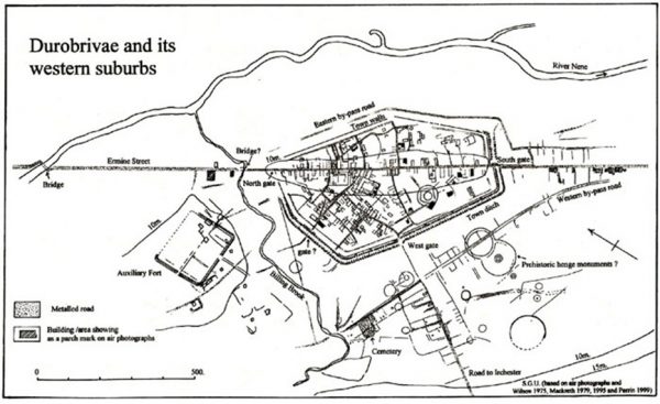
Map of Durobrivae – Stephen Upex
The Water Newton Treasure, a hoard of silver vessels and plaques dating to the late 3rd or 4th century, suggests a strong and wealthy Christian community within the town. It is the earliest group of Christian liturgical silver yet found in the Roman Empire.
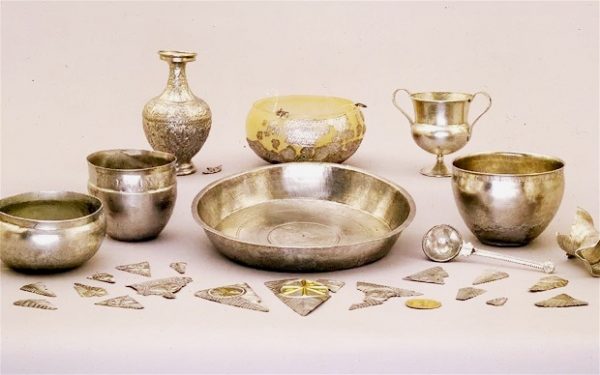
Water Newton Hoard
There are many Roman Villas in the surrounding countryside pointing to well organised agricultural production and prosperous landowners.
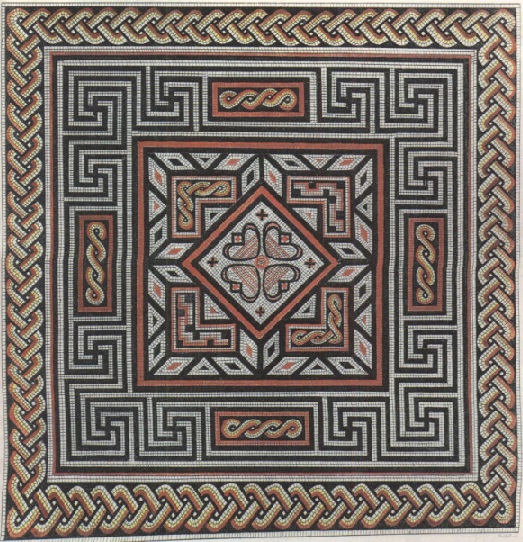
Roman Mosaic Pavement from Cotterstock
Towards the end of this period Roman control waned though it was only in the first decade of the 5th century that the field army was withdrawn and Emperor Honorius wrote to the cities of Britain advising them to look after their own defence.
After the end of Roman Britain, there is a break in written records. It is thought some of the Iceni may have moved west into the Fens to avoid the Angles, who were migrating across the North Sea from Angeln (modern Schleswig) and settling East Anglia.
By the mid 5th century however Peterborough was coming under Anglo Saxon influence. Under this new pagan regime coinage was no longer minted, the pottery industry declined, Durobrivae seems to have been abandoned, whilst new germanic traditions and new ways of life and death took hold.
Friesian comb from Roman-Saxon site at Orton Longueville
At Alwalton there was a cemetery where both cremation and inhumation took place. Finds there include 28 urned and 2 unurned cremations, and 34 burials. Pyre or grave goods were provided and some of the burials were richly furnished.
A chance discovery on an allotment in Woodston revealed the burial of a rich prince or warlord with a ceremonial, washing bowl placed on his chest; the 1300 year old coptic type bowl would have been made in the Mediterranean area.
When written records resume in Anglo-Saxon England, the names of a number of Fen communities are recorded in the Tribal Hidage and Christian histories. They include North Gyrwe (Peterborough and Crowland), South Gyrwe (Ely), the Spalda (Spalding), and Bilmingas (part of south Lincolnshire).
The area was ruled over by the pagan king Penda from 626 to 655, but his son Peada introduced Christianity to the Middle Angles region following his marriage to a Northumbrian princess. To help demonstrate his faith to his new Christian in-laws he founded a monastery in 655 at the Saxon village of Medeshamstede. The monastery was on the site of the current Peterborough cathedral. Saxwulf was the first abbott – and he went on to became the bishop of Mercia in 673.
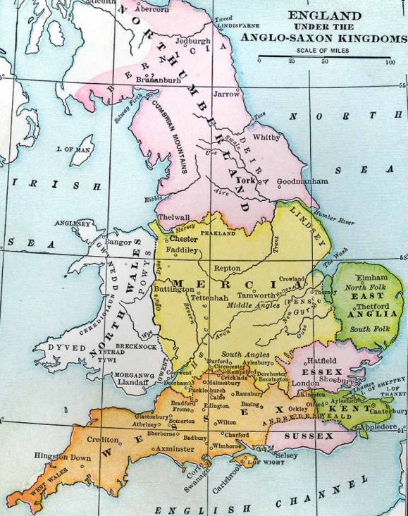
Anglo-Saxon Kingdoms
In the early Christian period a number of Christians sought the isolation of the wilderness that the Fens had become. These saints, often with close royal links, include Guthlac (Crowland), Etheldreda (Ely), Pega (Peakirk), and Wendreda (March). Hermitages on the islands became centres of communities which in some cases became monasteries with massive estates.
There had been incursions by Viking invaders before, but it was the arrival of the Danish Great Army in 865 which marked profound change in the Saxon kingdoms.
Viking grave marker at Lindisfarne
The abbey at Peterborough was plundered by the Danes in 870 and was abandoned. The later Christian records suggest all the monks were killed – though there is no hard evidence for this.
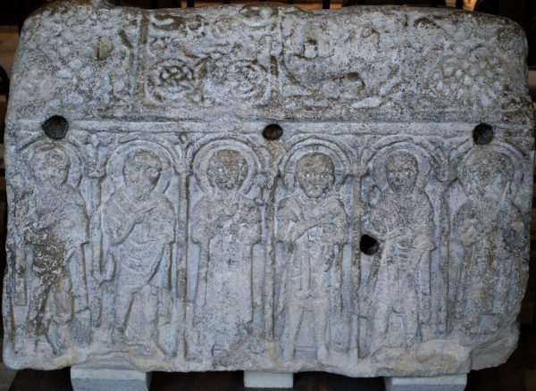
The Hedda Stone in Peterborough cathedral appears to mark the shrine of monks killed by the Vikings
It was 100 years after its demise that St Peter’s monastery at Medehamstede was revived. Hugh Candidus, a later monk of the Abbey, records that Aethelwold (bishop of Winchester) was directed to the burnt monastery by a vision and found “the stalls of cattle and sheep, and the whole place filled with foulness and uncleanliness.” A new abbey was built on the previous site in 972.
Under Danelaw the concept of the Soke was established; a soke was an area in which freemen were answerable to the court of their lord (in later times the Abbot of the monastery).
About 1000 AD a wall or “burgh” was built around the abbey to protect it from marauding Danes. There are references to Gildenburgh and then St Peter’s Burgh. The Abbot allowed the people of the nearby village to have a market. Soon Peterborough grew into a small town.
In 1070 an army of Danes landed in Eastern England and Ely was occupied. Disaffected Saxons, most notably Hereward the Wake, joined them in an attempt to overthrow the recently arrived, William the Conqueror. They sacked the abbey at Peterborough and burned the town, just as William’s newly appointed abbot, Torold, was approaching from Stamford.
The Norman response included the building of a castle between the monastery and the town which then lay to the east. Reflecting the lack of previous loyalty, William placed a heavy demand on Peterborough requiring the supply of 60 knights.
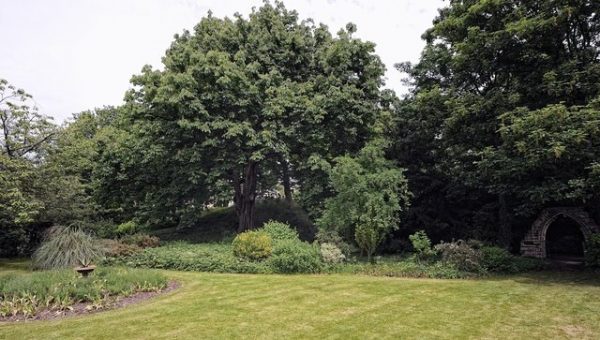
Peterborough Castle Mound – Tout Hill
The monastery and the town were rebuilt but in 1116 fire broke out in the abbey’s bakehouse and again both the abbey and the town were destroyed. Work on the new church began in 1118.
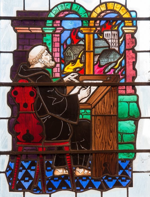
Benedict Chapel window depicting the great fire and writing of the Anglo-Saxon Chronicle
The town was also re-established, this time to the west rather than the east. The Marketstede was beyond the west gate, across the Tom Lock stream which ran from Westwood through a series of ponds (Hereward Centre) and down to the river. Cowgate and other familiar street names appear.
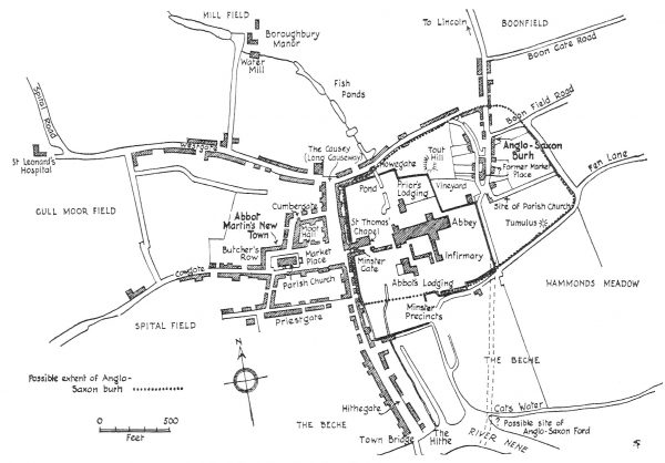
Medieval Peterborough Street Map – Steane
In 1189 Richard I granted a charter to Abbot Benedict for an annual fair – marking the growing importance of Peterborough as an agricultural and business centre.
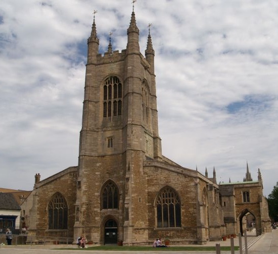
The monastic church was consecrated in 1238 and the structure of that time remains little changed to this day. The magnificent nave ceiling dates from about the 1240s.
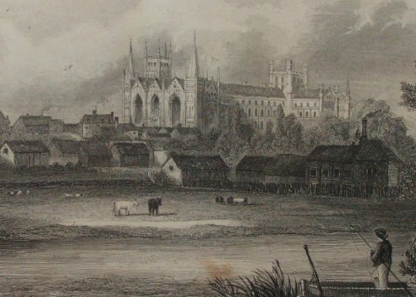
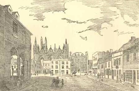
South-west view of Cathedral (19th century engraving)
13th Century windlass left behind in the cathedral roof
The abbots of Peterborough had total power over the inhabitants. They were responsible for law and order, plus the growth of the town and construction projects.
The first Town Bridge was built in 1308 to replace a ford to the east of the abbey. Made of wood, it evolved and survived right through until 1872.
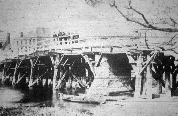
Peterborough Town Bridge
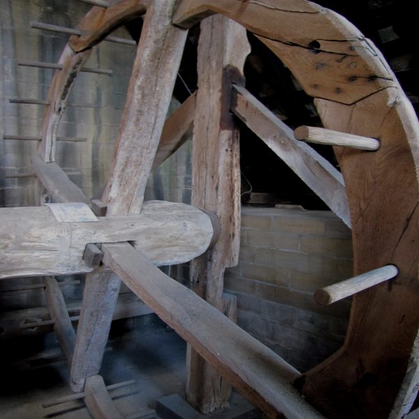
The Abbot’s grange or home farm was at Boroughbury to the north-west of the new town. It’s 13th century great barn survived for 600 years.
Tithes were stored by the Sacristan at Sexton Barns at the end of Cowgate. [They were later demoilished to make room for the railway station.]
Sexton Barns
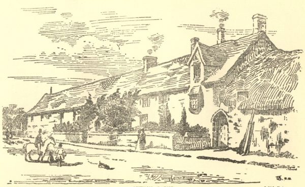
Between about 1290 and 1300 the three-storey tower at Longthorpe was added to an earlier house. Spectacular wall-paintings covering almost all available surfaces depict religious, secular and mythical subjects, along with heraldry and images of birds and animals.
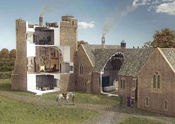
Longthorpe Tower – reconstruction by English Heritage
During the medieval period Peterborough’s main industry became the combing and weaving wool. “Cumbergate” is a reflection of this activity.
In 1407 the parish church of St John the Baptist in Cathedral Square was finished. (An earlier parish church had stood on the site of the Bishop Creighton Academy)
Parish Church – St John the Baptist
In 1439 Henry VI gave the Abbot the right to hold the “Bridge Fair”on St Matthews Day (21 September) and the 2 days following. It was to be held “in the County of Huntingdon as in the County of Northampton, on all sides of the bridge.”
Henry VIII’s dissolution of the monasteries came in the 1539. Whilst many other abbeys were destroyed, Peterborough had the good fortune to transform into a cathedral. It is suggested that this outcome was a consequence of the burial of Katherine of Aragon in Peterborough following her death in 1536 at her Kimbolton home.
At the creation of the diocese of Peterborough in 1541 most of the possessions of the former monastery were divided between the new bishop and the dean and chapter. The lordship of the Soke of Peterborough went to the bishop, while the urban community, now a city, passed into the hands of the dean and chapter.
In 1576, Bishop Scambler surrendered his lordship and it was granted the following year to Lord Burghley. The dean and chapter, however, having inherited the rights and liberties formerly enjoyed by the abbots in the city, had them confirmed by Queen Elizabeth in 1560. The dean, appointed by the Crown, was a quasi-mayor and soon began to be called ‘right worshipful’ rather than ‘very reverend’. The beginnings of municipal development are to be found in the creation in 1572 of a body of 14 feoffees.
The new city acquired the right to send Members to Parliament. Elections were dominated by the two principal families in the soke, the Cecils and the Fitzwilliams of Milton.
Burghley House was built for Sir William Cecil, later 1st Baron Burghley, who was Lord High Treasurer to Queen Elizabeth I, between 1558 and 1587
Milton Hall is the historical home of the Fitzwilliam family and the earliest elements of the current house were built in 1594.
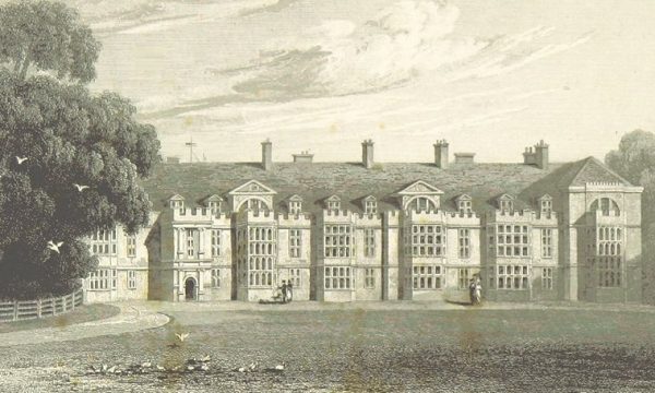
North Front of Milton Abbey – J P Neale, 1818
Nearby Fotheringhay Castle was the final place of imprisonment of Mary, Queen of Scots, who was tried and executed in the castle in 1587. Mary was buried in Peterborough Cathedral.
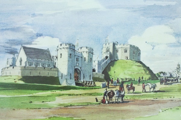
Fotheringay Castle – artist’s impression
In 1630 a group of wealthy landowners (the ‘Gentleman Adventurers’), headed by the Earl of Bedford, set out to drain the fens so that the peat soils could be used for summer cultivation and to prevent serious winter flooding. The Adventurers would be repaid for their investment by a grant of land. They hired in the Dutch engineer, Cornelius Vermuyden, to mastermind a drainage scheme using drains and wind power. Despite local opposition, by the end of the 17th Century much of the project had been completed, with the Bedford River and New Bedford River and Nene carrying water more quickly to the Wash.
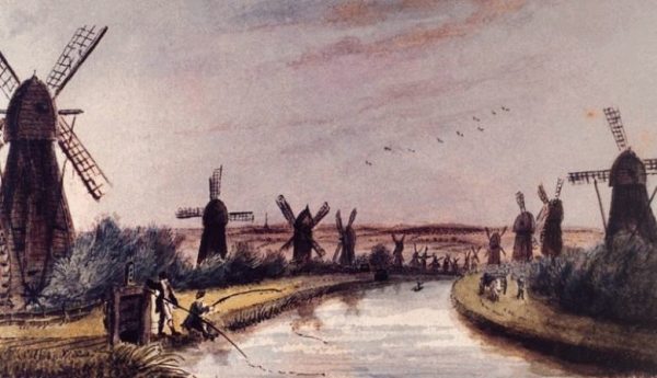
Windmills formed an important element of Fen drainage
When civil war broke out, Peterborough was divided between Cavaliers and Roundheads. The city lay on the border of the Eastern Association of counties which sided with Parliament
Horsey Hill fort was constructed by Parliamentarian forces in 1643-4 between Stanground and Whittlesey. It was a large gun emplacement (or sconce) to defend the Nene crossing – and the earthworks survive to this day.
War reached Peterborough in 1643 when soldiers arrived in the city to attack Royalist strongholds at Stamford and Crowland. The Royalist forces were defeated within a few weeks and retreated to Burghley House, where they were captured and sent to Cambridge. While the Parliamentary soldiers were in Peterborough they ransacked the cathedral, destroying the Lady Chapel, chapter house, cloister, high altar and medieval records. Their beer bottles, clay pipes and musket balls were found in abundance during the 2016 dig in the Dean’s garden.
Parliament disposed of Church property to raise money and Oliver St John bought the lease to the manor of Longthorpe and built Thorpe Hall (completed in 1656)
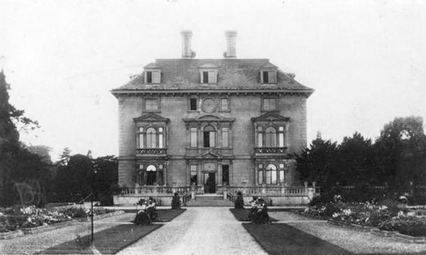
Thorpe Hall (c1915)
The Guildhall (or Butter Cross) in Cathedral Square was built by John Lovin between 1669 and 1671. It was originally a market building but was used as Peterborough’s town hall from 1874 until 1933.
Guildhall and Market Square 1795 (N Fielding)
In 1670 the Stamford Canal was completed enabling goods to reach Stamford from The Wash by way of Spalding and Crowland.
The 18th century saw regular investments to enhance the navigation of the Nene both downstream and upstream. These included Smith’s Leam, a straight cut from Peterborough to Guyhirn in 1728; and facilitated by a series of Acts of Parliament, the navigation to Northampton was completed in 1761.
By 1750 Peterborough has a population of about 3,000 and in 1774 the first theatre is built.
In 1790 the Custom House is built, and a body of men called Improvement Commissioners are given powers to pave, clean and light the streets of Peterborough.
In 1797 there was a further economic boost when Norman Cross was chosen as the site of the first purpose built prisoner of war camp – or “depot”. The prison was built by the Admiralty to hold prisoners from the Napoleonic wars and housed up to 6,300 prisoners, guarded by 500 soldiers.
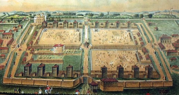
The Norman Cross Depot
Peterborough’s population in these 200 years grew from 3,000 to 160,000.
The city’s economy was transformed by the railways, then manufacturing, then services.
Crescent Bridge 1913
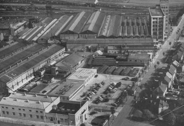
Baker Perkins Westwood Works in 1962
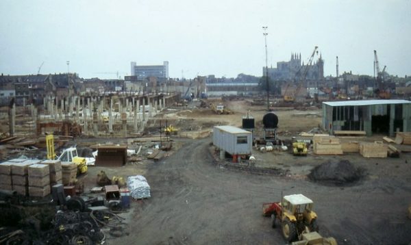
Peterborough city centre in 1978 during Queensgate construction
1821: An infirmary is built
1830: The streets of Peterborough are lit by gas
1840-50: Flour mills and warehouses constructed alongside River Nene
1845: The railway reaches Peterborough (lines to Ely and Northampton)
1846: Corn Exchange established on site of former theatre by St John’s church
1850: Second station with direct trains to London (and in 1853 north to Doncaster)
1852: Whittlesey Mere drained. Great Northern Hotel constructed
1856: St Peters Training College is built
1860: Foundation of Norwich and Peterborough Building Society
1880: Piped water and sewerage project completed
1897: Brick making starts at Northam brick yards
1903: Electric trams start running. WP&P (Baker Perkins precursor relocates from London to Westwood)
1906: Library opened on Broadway funded by Andrew Carnegie
1911: The first cinema opens in Peterborough
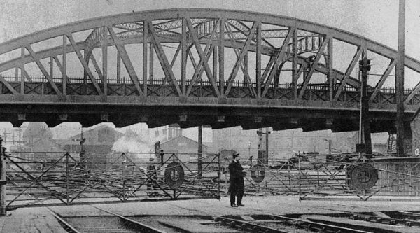
1913: Crescent Bridge opened to replace previous level crossing
1926: Sugar production starts at Oundle Road
1928: War Memorial Hospital is built
1929: City Museum opens. Hotpoint domestic appliance manufacture comes to Woodston
1932: Perkins diesel engine business established in Peterborough
1933: A new Town Hall
1934: A new bridge over the Nene – with recently widened Bridge Street to the north.
1934-5: First season for Peterborough United Football Club
1936: The Lido swimming pool opens
1937: Odeon cinema opens
1940-42: Luftwaffe bombing attacks (including Cathedral and Town Hall – 10 Aug 1942)
1950: Dogsthorpe Estate provides extensive publicly funded new housing
1960: Start of major expansion of Peterborough District Hospital
1964: Hereward Cross Centre opens
1967: Development Corporation formed to double the population to 160,000
1971: The Angel Hotel (former coaching inn with origins in 16th century or before) makes way for W H Smith
1973: The Key Theatre is built
1977: Thomas Cook opens new headquarters at Thorpe Wood
1982: The Queensgate Centre opens
1988: Creation of Nene Park Trust
1989: The Rivergate Centre opens
1991: New gas fired power station commissioned in Fengate
1999: Tesco hypermarket opened at heart of new Hampton township
Peterborough History – Websites
Peterborough History – Books
- “Peterborough” H F Tebbs ISBN 0-900891-30-0
- “Peterborough and the Soke” Baxter, Hall & Marx (eds) 978-0-367-17382-1

