The 2019 Peterborough Extensive Urban Survey Report is the outcome of a project by Peterborough City Council and Cambridgeshire County Council with funding from Historic England to collate and re-evaluate the city’s known urban archaeological resource. It followed on from a previous survey which was focused on the Cathedral and its precincts.
One objective was to enhance the existing Peterborough Historic Environment Record database to create a baseline for the report. This resulted in the creation of approximately 120 new records derived from
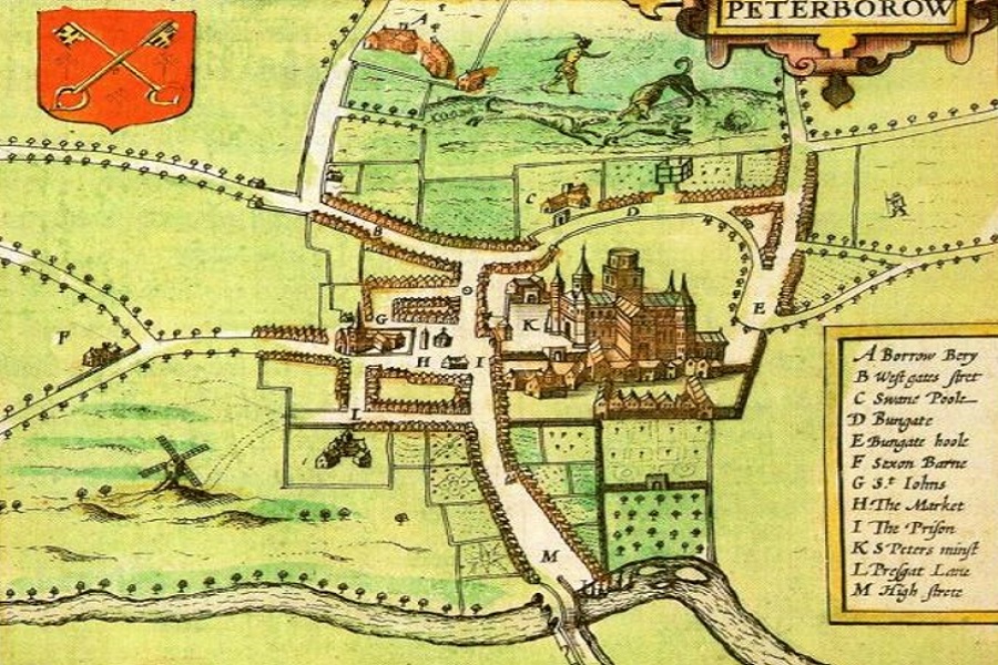
cartographic and documentary evidence primarily dating to the late post medieval and modern periods.
The area covered is that of the pre 19th century city centre – extending roughly from the Butterfly Hotel in the west to the Boongate roundabout in the east; and from Central Park in the north to the football ground in the south. A total of 167 separate archaeological “interventions” were identified including 70 within the Cathedral Precincts.
The report tracks the history of Peterborough from the Mesolithic to the modern day. It is far reaching in the range of topics covered and represents a useful guide to the information and reports available to those interested in Peterborough archaeology and history.
Did you know?
- At the time of Domesday Peterborough was recorded as containing just 52 households made up of 37 villagers, 8 smallholders and 7 slaves
- Coins bearing the mark of Leofwine suggest there was a mint in Peterborough in Norman times
- 19th century cartographic sources indicate there were 4 breweries and 6 malt houses serving as many as 52 pubs, inns, and hotels

