The largest Roman centre in the Peterborough area was Durobrivae. There are no longer any visible remains other than lumps and bumps in a field close to the A1. During August 2016 archaeologists undertook a series of non invasive surveys to help improve our understanding of what lies below the ground.
The Roman town of Durobrivae was located close to Water Newton. Ermine Street, the Roman route from London to Lincoln ran through the middle of the town. There was a bridge over the Nene immediately to the north.
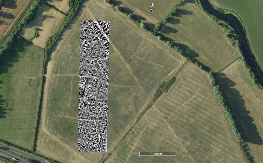
There is a great deal going on in the results. Ermine Street shows clearly running across the NE corner of the survey transect and exactly matches the parch mark on aerial photographs. Either side of Ermine Street are a series of buildings with their gable ends onto the road in the approved Romano-British manner. Other streets can be seen, again matching the parch marks. Not all the buildings are so clear, but there are clearly other walls that can be seen in the data. Towards the south, the pattern is more complex.

