Several FRAG members helped with a geophysical survey across parts of the Durobrivae site near Water Newton, Peterborough.
The survey work required the explicit permission of Historic England which is responsible for the Roman Peterborough site. The work was co-ordinated by volunteers from the Community Archaeology Geophysics Group (CAGG) with technical input from Kris Lockyear of UCL. There were two main areas of focus which were investigated using magnetometery, earth resistance and ground penetrating radar.
One area is close to what is believed to be the civic centre of Durobrivae. The apparent outline of a Romano-British temple was discovered by the team last year and further work was needed to help interpret this.
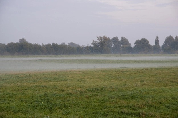
The second area is a round feature long known from aerial photographs. It has been explained as an Iron Age “tumulus”, but its relevance within the Roman town is little understood. The end of day mist in the photo above neatly defines the raised circular area.
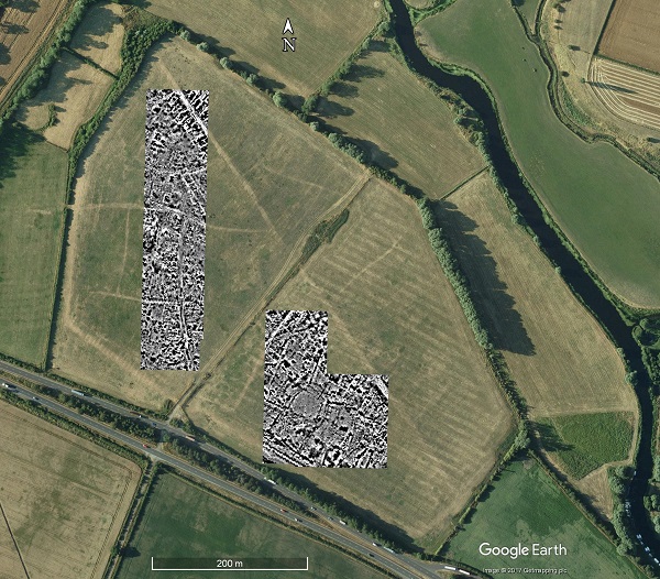
Areas surveyed by magnetometry
The analysis to date is presented in a detailed blog post on the Herts Geosurvey website.
Temple Area
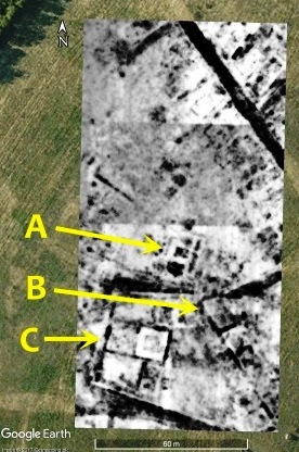
Example of GPR scan showing Ermine Street running diagonally at top with distinctive square temple feature towards bottom.
A Buildings to north of temple
B Large building to east of temple
C Boundary wall of the temenos (holy grounds) of the temple
- Good definition of the temple and its position relative to nearby buildings and roads
- Curious curved features between the temple and the major structure to the east
- Possible circular shrine to north of main temple underneath a robbed rectangular building
“Tumulus” Area
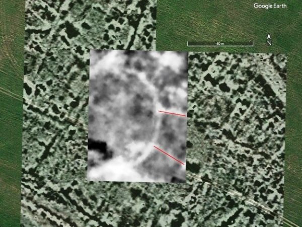
Resistivity overlaying Mag
- Absence of much at all under the second round feature (“tumulus mound”)
- A clearly defined outer circle around the feature
- Two linear features run from south/east side of the circle between which there is a largely open area

