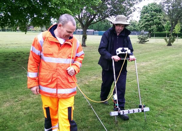
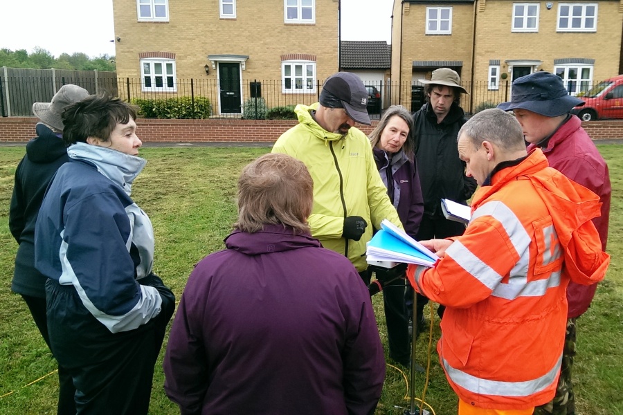
FRAG members underwent geophys training with Phil Hill in Itter Park today.
A second session in the afternoon gave YAC members the chance to get hands on with the technology.
The main objective was to introduce the principles and practicalities of both resistance and magnetometry surveying. By using a site adjacent to the Fane Road villa we also hope that we might find more clues concerning the roadway to the villa.
The primary tool used was the RM85 Resistivity Meter (on loan from Jigsaw). First step was to create the grid of 20m x 20m squares – with the help of pythagoras. Then some careful scrutiny of the instruction sheet! Everybody had a go and speed of surveying soon increased dramatically. We now eagerly await analysis of the results by Kev. We’ll update this post once we have news!

Geophys Results Update

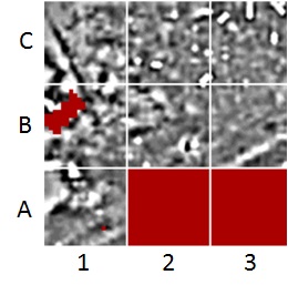
This is the ghostly image we are left to interpret after a lot of processing and filtering of the raw resistivity data.
Even though our primary objective was training, Kev Redgate has been able to identify a number of features worthy of further investigation. The following comments are extracts from his preliminary report.
Summary
The results, whilst secondary to the training purpose, have revealed some anomalies of interest, specifically; the strong low resistance north-northwest – south-southeast linear anomaly in C1 and extending in to B1, the weak high resistance mass in A1 and the six rectangular strong high resistance anomalies in C2/C3.
Analysis
- the corner of the enclosed play area can be clearly seen as a high resistance feature bounded by low resistance linear features on the west edge of the of the B1/C1 juncture.
- the gas pipe known to run through the survey area is clearly visible as a west-southwest – east-northeast linear feature of weak high resistance in the southeast corner of the A1 and reappearing as strong high resistance in the southern half of B3.
- the dew pond evident on the early OS maps appears as a strong low resistance anomaly at the juncture of A1/A2/B1/B2.
- the strong high resistance mass in C1 is predominantly geological. The weak low resistance north-northwest – south-southeast cut in this mass is clearly evident as a strong low resistance linear anomaly that extends in to B1. There is no apparent relationship to other features or anomalies and warrants further surveying north and west of C1 in order to determine the extent of this anomaly.
- the weak high resistance mass in the northwest corner of A1, bounded by strong high resistance anomalies is suggestive of structure rather than geology. Further surveying to the west of A1, along with magnetometry survey is warranted.
- the weak high resistance linear anomaly in A1 on a southwest – northeast alignment north of the gas pipe re-appears as a very weak low resistance anomaly in B2 and B3. Although its proximity to the gas pipe suggests an association, the differing alignments merit further interest.
- the six rectangular strong high resistance anomalies in C2/C3 measure between 3-4m in length and all but one are 2m in width; the other being 1.5m. Resurvey of these grids with shorter traverse intervals and magnetometry survey should be considered in the first instance.
We would like to thank Peterborough City Council and the Friends of Itter Park for their help and co-operation in making this exercise possible.


